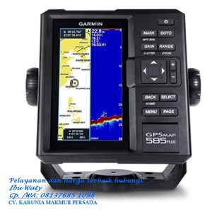
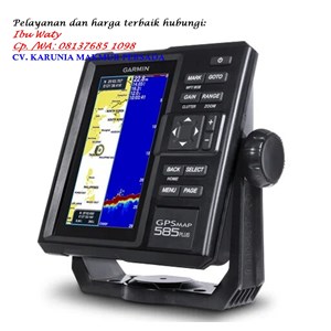
Detail GPS MAP 585 PLUS GARMIN
GPS MAP 585 PLUS GARMIN
GPSMAP 585 Plus mencakup sonar CHIRP, teknologi sonar tercanggih yang tersedia untuk memancing dan berperahu bagi publik. Sonar CHIRP memberikan pemisahan dan definisi target yang sangat jelas karena menempatkan lebih banyak energi ke target daripada sonar tradisional. Perangkat juga dilengkapi kemampuan perekaman sonar yang mengoordinasikan waktu kembalinya sonar dengan posisi kapal Anda dan menyimpan informasi digital untuk diputar di komputer menggunakan perangkat lunak perencanaan HomePort™. Gunakan kabel berbagi data pengguna untuk berbagi titik arah dan rute antara beberapa perangkat.
Physical & Performance
Physical dimensions
176.0 mm x 190.0 mm x 66.0 mm (6.93” x 7.48” x 2.60”)
Display size, WxH
2.83" x 5.36"; 6.0" diagonal (72.0 mm x 136.2 mm; 152.4 mm diagonal)
Display resolution, WxH
480 x 800 pixels
Display type
WVGA display
Weight
816.0 g (1.80 lbs)
Water rating
IPX7
GPS receiver
GPS/GLONASS/BeiDou, internal
NMEA 0183/RS422 compatible
Power consumption
7.6 W
Voltage range
10V - 36V DC input
Mounting options
Bail or flush
Maps & Memory
Preloaded maps
GPSMAP 585 Plus, APAC (worldwide basemap)
GPSMAP 585 Plus, w/g2, SEA (built-in SEA g2 chart)
Accepts data cards
2 standard SD
Waypoints
12,000
Routes
200
Track log
one 50,000 points active track; 100 saved tracks
Chartplotter Features
Garmin Sonar compatible
Supports AIS (tracks target ships position)
Supports DSC (displays position data from DSC-capable VHF radio)
Tide tables
Sonar Features & Specifications
Transmit power
600W (RMS)
Sonar Frequency
50/77/200kHz CHIRP (Low, Mid, High)
ClearVü™
(built-in)
Scanning Sonar Frequency
CHIRP 260/455/800kHz
Maximum depth
2,300 ft, freshwater, 1,100 ft, saltwater (depth capacity is dependent on water bottom type and other water conditions)
Bottom lock (shows return from the bottom up)
Water temperature log and graph
Split-screen zoom
Fish Symbol ID (helps identify fish targets)
Sonar recording
Sonar history rewind
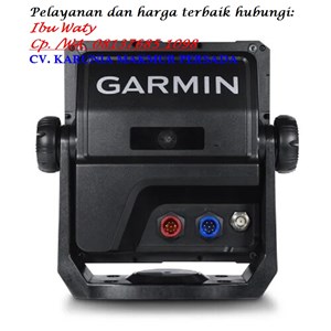
Connections
Transducer Connector Pin Numbers
8
8-Pin Power/NMEA 0183 Connector
1
BNC for External GPS Antenna
1
Kami juga menjual GPS Mobil, Theodolite dan Alat Survey lainnya
Tampilkan Lebih Banyak